
Location PEDERÜ.
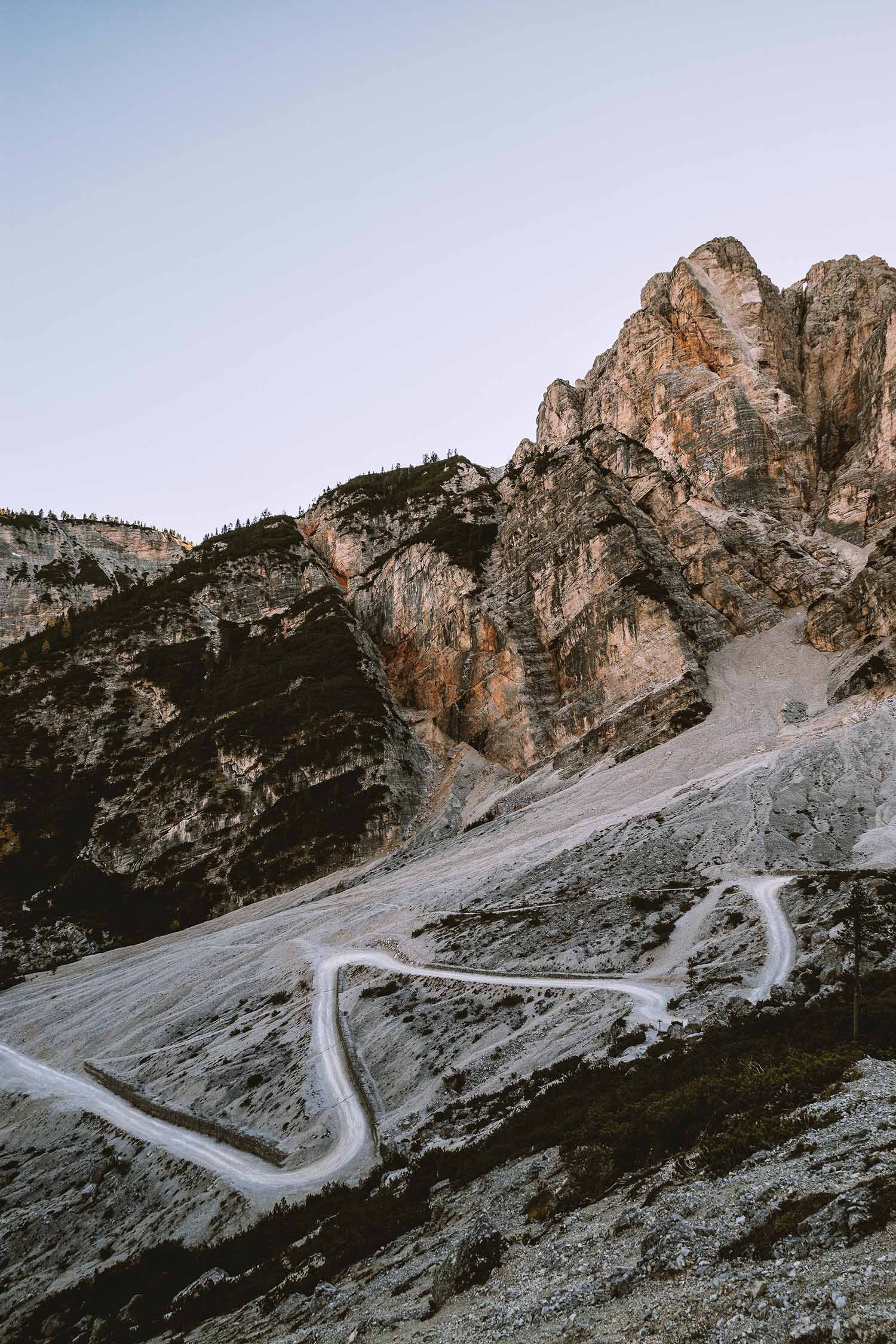
From the legendary wars of the Fanes Kingdom to the unfortunately real ones. In 1915, when Italy entered the First World War, the Austrians (the area was still part of the Austro-Hungarian Empire at the time) built a populous military village in Pederü. It was the encampment of the Kaiserjäger (the imperial hunters, i.e. the infantry of the army) who from here could easily reach some of the area's battlefronts such as the Valparola Pass, Forcella Lerosa, Lagazuoi etc. In the 1920s, when the war was over, the military village was largely destroyed. A few huts were saved, among them the officers' hut, which later became the refuge you can still find today, while the remaining ones were used as stables, warehouses or storage.
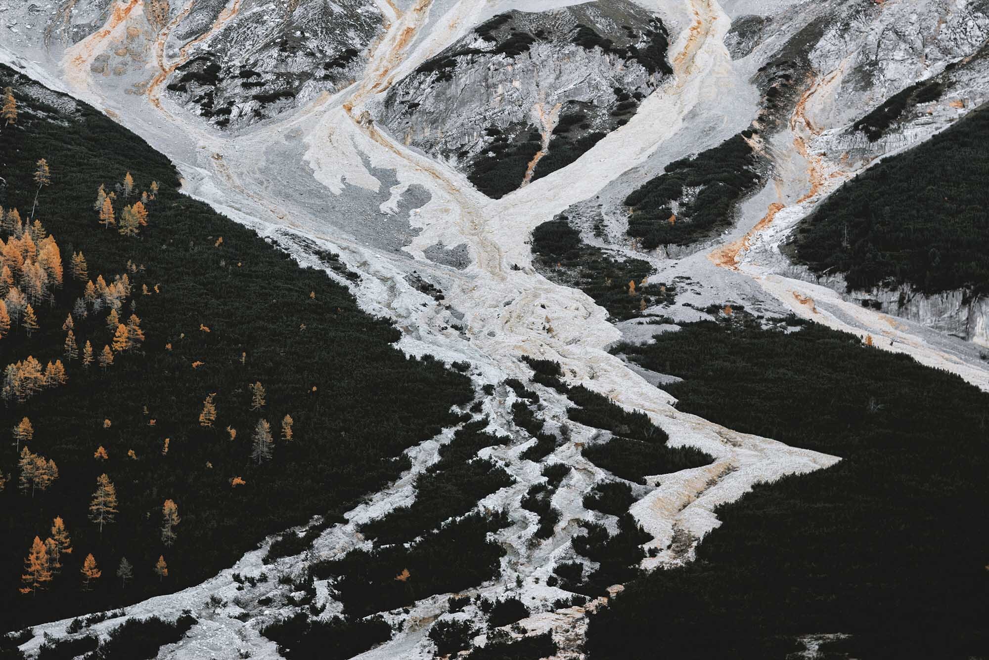
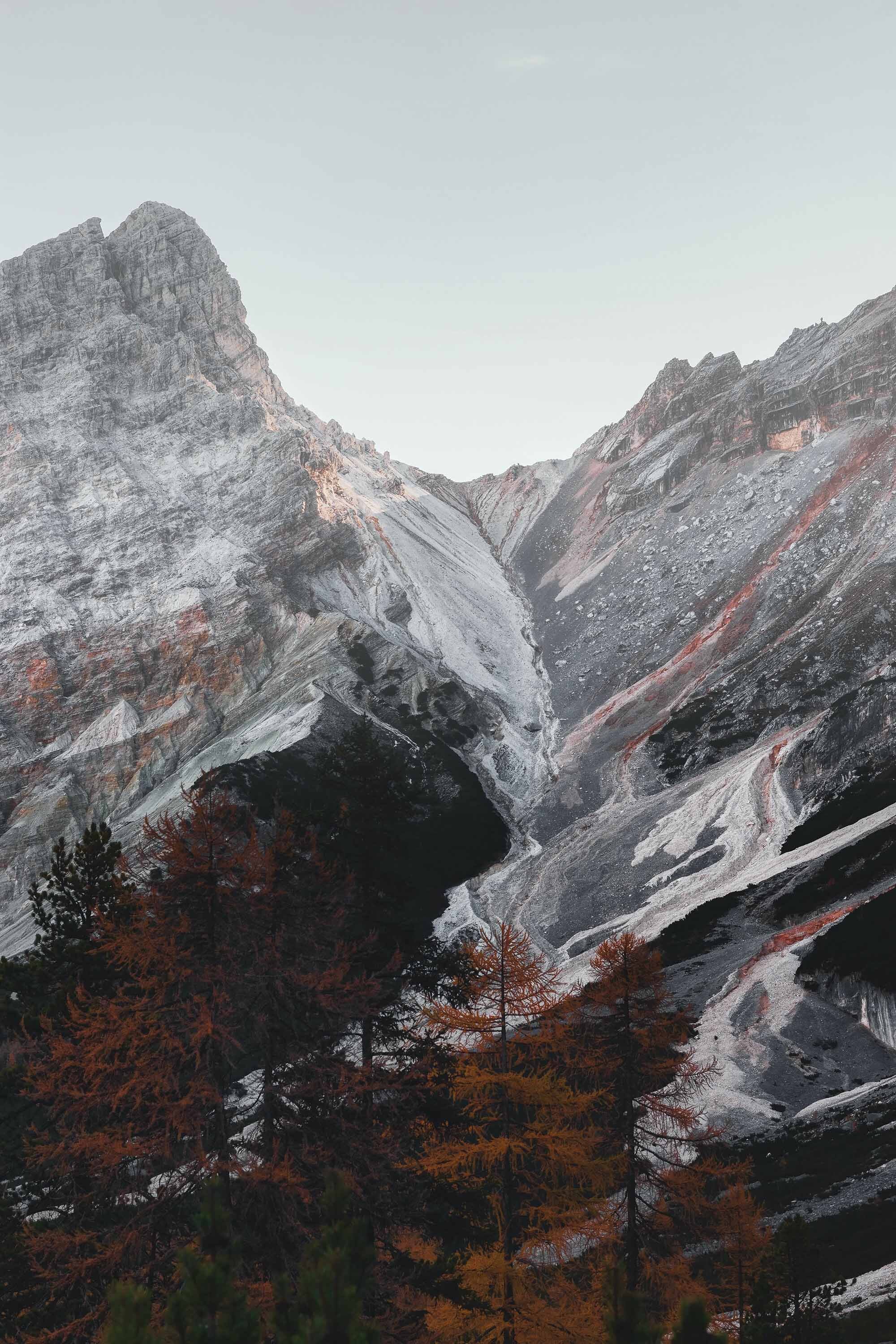
The reason why the camp was built in this location, apart from being strategic, is the abundance of water resources. In fact, very well known and abundant are, since ancient times, the natural springs that, even today, provide a large part of the population of San Vigilio di Marebbe (which annually consumes about 250 million litres) with water. The water reaches the springs after an underground route of over two kilometres that descends from the karstic plateau of Fanes. It re-emerges in Pederü and then returns underground, during many times of the year, hiding in the screes and stones of the Val di Marebbe. It hides underground during the autumn, winter and dry periods, but around June it re-emerges again further down the valley. Famous, for example, is the natural spring of the 'Ega de San Vì' (the spring of San Vito), which gushes out every year punctually in the middle of June (San Vito is celebrated on the 15th of this month) to dry out again in early autumn. Also famous is the nearby natural monument Les Fontanes (the Province of Bolzano has a special register of natural monuments, to which you will find the link below), where the water gushes out from forty springs, a true spectacle of nature that also feeds the stream.
-
https://it.wikipedia.org/wiki/Rifugio_Peder%C3%BC
https://parchi-naturali.provincia.bz.it/fanes-senes-braies/habitat-del-parco.asp
https://ambiente.provincia.bz.it/acqua/sorgenti-minerali.asp?news_action=4&news_article_id=547376
https://www.provincia.bz.it/natura-ambiente/natura-territorio/tutela/monumenti-naturali.asp
-
Pederü Hut https://g.page/Pederue?share
Accessible by car-van
-
Ed. 2021 - www.smach.it/vaz
-
〉 Ladin
Pederü, olache la ütia á ince inom insciö, é n post tl Parch natural de Fanes-Senes-Braies a 1.548 m d’altëza. Canch’al ê rot fora la Pröma Vera dl monn â i soldas fat sö cotan de baraches por podëi sté püch dalunc dal front de vera. Ti agn 1920 â le Rëgn dla Talia inciarié Angelo Pisching da trá jö ci che restâ dl vedl paisc di soldas. Da borjé le lignan âl fat ciarbun adinfora. Ma püces baraches n’ê nia gnüdes trates jö. Por ejëmpl ân lascé chëra di ofiziers, che ê spo deventada la ütia da sëgn. Les atres baraches ch’an â lascé gnô tutes sciöche stala, magazin y logher.
〉 Italiano
Dalle guerre leggendarie del Regno di Fanes a quelle purtroppo reali. Nel 1915, all’entrata dell’Italia nel primo conflitto mondiale, gli austriaci (ricordiamo che all’epoca la zona faceva ancora parte dell’Impero Austro-ungarico) costruirono a Pederü un popoloso villaggio militare. Era l’ accampamento dei Kaiserjäger (i cacciatori imperiali, cioè la fanteria dell'esercito) che da qui potevano raggiungere con facilità alcuni fronti di battaglia della zona come il Passo Valparola, la Forcella Lerosa, il Lagazuoi ecc. Negli anni Venti del Novecento, a guerra finita, il borgo militare venne in gran parte distrutto. Poche baracche si salvarono, tra queste quella degli ufficiali, che divenne in seguito il rifugio che trovate ancora oggi, mentre le restanti vennero adibite a stalla, magazzino o deposito.
Il motivo per cui l’accampamento fu costruito in questo luogo, oltre all’essere strategico, è l’abbondanza di risorse idriche. Molto conosciute e ricche sono infatti, fin dai tempi antichi, le risorgive che, ancora oggi, danno da bere a gran parte della popolazione di San Vigilio di Marebbe (che annualmente ne consuma circa 250 milioni di litri). L’acqua giunge qui dopo un percorso sotterraneo di oltre due chilometri che scende dall’altopiano carsico di Fanes. Riemerge a Pederü per poi tornare, in molti periodi dell’anno, sotterranea, nascondendosi nei ghiaioni e i sassi della Val di Marebbe. Infatti durante l’autunno, l’inverno, i periodi secchi, l’acqua si nasconde sottoterra, ma intorno a giugno riemerge nuovamente più a valle. Famosa, per esempio, è la risorgiva dell'“Ega de San Vì" (la fonte di San Vito) che sgorga tutti gli anni puntualmente alla metà di giugno (il15 del mese si celebra il santo) per esaurirsi di nuovo nei primi mesi d’autunno. Inoltre famoso è anche il vicino monumento naturale Les Fontanes (la Provincia di Bolzano ha un apposito registro di monumenti naturali di cui sotto trovate il link), qui l’acqua sgorga da quaranta sorgenti, un vero spettacolo della natura che alimenta anche il torrente.
La ricchezza d’acqua è stata nel passato molto importante. Già nel 1296, infatti, sul Rio San Vigilio, esistevano ben 4 mulini ed accanto ad essi, lungo un tratto di torrente di appena 3 chilometri, sorsero nei secoli ben 30 imprese artigianali come segherie, fucine, cardatori di lana, concerie, falegnamerie ed altre ancora. Oggi tali laboratori sono tutti spariti ma al loro posto sono sorte 5 centrali elettriche che riescono a coprire l'intero fabbisogno del centro turistico di S. Vigilio.
〉 Deutsch
Pederü, wo sich auch die gleichnamige Hütte befindet, liegt im Naturpark Fanes-Sennes-Prags auf 1.548 m Höhe. Nach Beginn des Ersten Weltkriegs errichteten die Soldaten dort einige Baracken, um in der Nähe der Front bleiben zu können. In den 1920er Jahren erhielt Angelo Pisching den Auftrag, die Überreste der Militärsiedlung abzutragen. Nur wenige Baracken wurden nicht abgerissen, darunter die Offiziersbaracke, die zur Berghütte umgewandelt wurde. Andere Gebäude hingegen wurden in Ställe, Scheunen und Lagerräume umgewandelt.